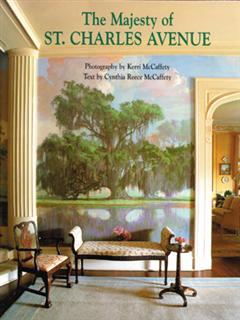
A five-mile trip down the eclectic, tree-shrouded boulevard that traces the history of New Orleans' "American" expansion.
"If the people of New Orleans can come to Carrollton in twenty minutes, and by steam … they will come by the thousands ... the intervening avenue will, like the street of palaces in Venice, be lined on both sides with magnificent abodes, the luxurious homes, either of wealth retired, or wealth yet in its industrial harness."
So wrote railroad manager Thomas Harper in 1837 about the future of the boulevard that would run alongside his young rail line. A century and a half later, St. Charles Avenue stands as a glorious fulfillment of that prediction.
Venerable, maternal live oaks arch protectively over five miles of avenue, shepherding the streetcars along between the palm trees and azaleas. The first time you turn onto St. Charles, you're overwhelmed with a sense of green—ancient, fecund, and rich, a leafy, living tunnel.
Then you see the houses. The Queen Annes and the Colonials, the colleges and churches, massive stone manors and dignified villas rise along the avenue as if rooted in their setting, lined up as far as you can see. Some rise alone in the center of a full block, while most stand in groups of four, five, or even six in a span, leaning in at angles on the curves as if growing toward the sunlight.
The jewel of America’s grand avenues, St. Charles Avenue is the verdant ribbon connecting the oldest area of the city to the newer enclaves at the other end of its river-drawn geography. It weaves through the neighborhoods in both a linear and a chronological progression, from Canal Street through the early-nineteenth-century commercial buildings of the Central Business District and around Lee Circle into the Lower Garden District, where many houses have stood since the 1850s. Continuing upriver, it moves through the sites of old plantations and settlements, where scattered rural villas were joined by newer construction in the 1870s, and then into the last stretches of the Avenue, with the universities and Audubon Park, a stretch of residences that appeared at the close of the nineteenth century. Rolling into what was once the far-flung village of Carrollton, St. Charles Avenue has connected both ends of the fabled crescent, neatly spanning five miles and almost 200 years.
The stem of what would become St. Charles Avenue appears in a 1759 map—a dirt road leading straight out into the swamp from the western end of Nouvelle Orleans’ Rue Royale. [figure1] Beyond that rudimentary sketch, the trail likely veered down toward the river where a rough road ran along what was then called the Tchoupitoulas Coast.
Through most of the eighteenth century, the colonial village occupied only the area that is now the French Quarter, less than a mile square. After a devastating fire in 1788 that destroyed most of their structures, the citizenry looked to the land just west of the town, to what is now the Central Business District, for expansion. A Frenchman, Beltram Gravier, had acquired the section nearest Nouvelle Orleans through an auspicious marriage. He began carving out lots after the 1788 fire, with a Spanish royal surveyor named Don Carlos Laveau Trudeau, and initially dubbed his new faubourg (French for suburb) Ville Gravier. After the death of his wife, Marie, he renamed it St. Marie.
Gravier named some of the streets in his faubourg after landmarks, like Magazine, from the French magazin, or warehouse, and Camp, after an slave encampment. Others were named after early residents, like Poydras and Girod. But the street running along that vestigial dirt trail, the one that would have been Royale if not for the gap between the settlements, was named to honor King Carlos III of Spain, who held title to the colony at the time. Calle San Carlos—St. Charles—would become the main street of the new faubourg.
As more and more Americans and other non-French flocked to the busy port colony just before and after the Louisiana Purchase, St. Marie expanded and became the logical place for them to settle. The old city, the French Quarter, was a dense stronghold of Creoles (American-born descendants of French or Spanish colonists) whose concept of the Anglo population had been tainted by the adventurers and speculators, the volatile flatboatmen and other river ruffians. The Creoles liked their little colony just the way it was—French.
A vacant wedge known as the Commons lay between the rectangle of St. Marie and the French Quarter. Just wide enough for the old Spanish fort on the river’s edge, the open area broadened slightly going inland, but its wide end measured less than the length of three blocks. Still, the streets of the Faubourg St. Marie were not mated in name with those in the old quarter. Perhaps the residents thought it unlikely that the twain would ever meet, what with the vaunted Creole/American animosity. And there was a canal on the drawing board in that space—a canal that never materialized except as a street name.
The forgotten canal lane embodied the tension between the French Quarter and the encroaching Americans. Even after St. Marie bulged into the vacant Commons and the double lanes of Canal Street had been laid out, the citizens saw the resulting median as a neutral ground between the cultures. Eventually every street median in the city would be known as a neutral ground.
St. Charles was just one of the streets to change identity upon crossing wide Canal. Yet for the former San Carlos, the confusion wouldn't stop there. The street would become an avenue in its next extension, with yet another name—Cours des Naïades.
In 1807, a visionary French architect and surveyor, Bartheleme Lafon, designed a classical plan for the faubourg beyond St. Marie, roughly in the area that would become the Lower Garden District. With a circular park, where Lee Circle now stands, as a pivot point, he angled the new street slightly to parallel the curve in the river, made it double the width of the other streets, and named it Cours des Naïades (later spelled Nayades in English) after the river nymphs of Greek mythology. A few streets inland toward the cypress forests, he evoked the mythical spirit of the wood sprites in Dryades Street, and named the parallel streets in between Apollo, Bacchus, and Hercules—now Carondelet, Baronne, and Rampart. His cross streets, named for the nine muses of Greek mythology, still survive: Calliope, Clio, Erato, Thalia, Melpomene, Terpsichore, Euterpe, Polymnia, and Urania.
Lafon's plan included tree-lined canals and streets, fountains and parks, and classic schools and theaters, all within an intricate grid deftly fitted into the curving terrain. His concept of a planned environment in the classical mode represents one of the earliest expressions of the Greek Revival movement in New Orleans.
Grand homes in the Greek Revival mode sprang up along many streets and avenues in the city, especially between 1820 and 1850. After that, residential fashion took different directions, but the Greek influence still infuses the façades and the interiors. In the new suburb, the front gardens, wide porches called galleries, and pillared façades were in direct contrast to the Creole style, which emphasized modest exteriors close to the street and cool rear courtyard gardens.
While Lafon’s grand plan was never fully realized, his Greek-inspired label for Nayades Avenue endured for 45 years, and the wide dirt road stretched ahead, running through the suburban communities of Lafayette and Jefferson City, where it ended, until a real estate venture and its railroad pushed it onward.
Until the unification of the city in 1852, the street called Royal turned into St. Charles at Canal but became Nayades at the circle and even First Street at its Carrollton end. With unification, city council declared that everything above Canal Street would be called St. Charles. Old Royal and the other French Quarter street names remained intact behind their neutral ground.
A STREETCAR NAMED ST. CHARLES
In 1835 the New Orleans and Carrollton Railroad completed the connection between the French Quarter and the first big bend upriver, and added the steel rails right down the center that would be so influential in determining the character of the Avenue. It was among the first railroads in the United States, and only the second one completed west of the Appalachians. The small railroad went on to evolve into what is today the oldest streetcar line in the world.
The placement of the route was a compromise. From the earliest days of the colonial presence, the significant houses had been built along the river. Splendid estates blossomed there early in the nineteenth century. Then the character of that area evolved to accommodate the explosive success of the port. Astonishing levels of commercial activity coming downriver from the burgeoning Midwest, especially after 1803 when the Louisiana Purchase eliminated Spanish restrictions, helped create vast wealth but degraded the area for residential aesthetics. Pigs and sheep arrived by barge, and herds of cattle were ferried across the river from the terminus of a Texas trail ride, bringing stockyards and abattoirs to the neighborhood. The more affluent sought homesites away from the waterfront, and the neighborhoods reached inland toward the back of town.
They could only go so far. The placement of Nayades as a route from New Orleans to Carrollton represented a middle ground between the longer river-front arc and a direct, straight line, which was impractical because of the boggy swamp it would have crossed. The resulting route lay, according to contemporary journalists, along a "level and beautiful country; very high, dry and arable land."
A group of bankers had bought the old Macarty plantation five miles upriver from the French Quarter at the western point of the big, wide curve in the river. At that time, the only way to get to the upriver plantations was by a rough road along the river bank, or by boat. Cypress swamps, pastures, and palmetto inhabited the inland terrain.
The bankers, as developers of the new town of Carrollton, got busy remedying this deficit. Before slicing the first lots from the old plantation, the ardent investors sold their fellow citizens on the idea of public transport to connect the horns of the alluvial curve. The New Orleans and Carrollton Rail Road was to be powered by a recent English invention, a steam-powered engine gliding upon iron rails.
By 1835 Carrollton had a handful of houses and a resort hotel in the works, and the speculators had their lifeline to New Orleans and its 60,000 citizens.
On Saturday, September 26, 1835, the New Orleans Bee covered the historic event:
The Rail Road from the city to Carrollton on the Mississippi, distant about four and a half miles, was opened for travel on Saturday last … affording one of the most pleasant drives in the southern states. It passes through the limits of an ancient forest of live oaks; peculiarly interesting as being one of the very few of its kind now remaining in the south.
St. Charles, the Avenue, still ended short of Carrollton by some distance. In 1835 it coursed, partially surfaced with stones, from Canal through Faubourg St. Marie upriver to Tivoli Circle, and from there, unpaved, on through Lafayette City and the scattered settlements beyond. After that, nothing but a pair of rails blazed the way through the forest depths ahead. In fact, neither horseback riders nor any other vehicles were permitted along the road in the hinterland, because of the difficulty of maintaining the roadway.
In 1837 the railroad company completed a second set of tracks alongside the first. A racetrack joined the attractive Carrollton Hotel as a popular outing, and the NOCRR was in business to stay. Its diminutive steam engines pulled as many as seven cars at one time and carried both passengers and freight.
Just three years later, in 1840, the population of New Orleans had swelled to over 100,000, making it the fourth largest city in the nation. Anglo-Americans and Irish, German, and Italian immigrants came in torrents to the best place in North America to make the most money in the shortest time. The Crescent City was well on its way to proving Thomas Jefferson’s comment after the Louisiana Purchase that “no such position for the accumulation and perpetuity of wealth and power ever existed.”
In the 1850s, the municipality of New Orleans began annexing the neighborhoods and scattered settlements in the path of its rampant growth, but still, the area below Carrollton was largely rural. Loose cows still wrought havoc along the railway in that stretch.
The Civil War brought Federal occupation in 1861, and plenty of demand for the Carrollton railroad. The population ballooned to 175,000 in that decade, and both passenger and freight traffic streamed down the middle of the Avenue, as well as up and down the major cross streets. While houses continued to multiply along much of St. Charles, the Carrollton end had wide expanses that were vacant.
Those who had fulfilled Thomas Harper’s prophecy and built their magnificent abodes on the intervening avenue eventually grew impatient with the raucous engines and the velocity of the steam cars. Dogs, cows, and the occasional pedestrian had been sacrificed to speed. Something had to change.
After the war ended, Civil War hero General P. T. Beauregard took the helm of the NOCRR and instituted improvements. Slower, quieter mule- or horse-drawn cars replaced the noisy coal-burning locomotives. The trip from New Orleans to Carrollton now took longer, but ladies no longer had to fear they would arrive on fire because of flying cinders, and the residents could rejoice in the return of peace to their bucolic suburbs.
With the end of Reconstruction in 1877, another era of unprecedented opportunity opened for the city. The banana barons, the cotton kings, the shipping magnates, and the bank presidents again set about creating monuments to their own achievement in the form of ever more stately villas, chateaus, and Georgian temples.
Real estate speculation had also made many a fortune in this fat curve in the Mississippi, starting when the explorer Bienville first drew a line and subdivided his large royal bounty. A new concept appeared in the 1880s—the speculative house sold on a payment plan. With this development, the bank teller could live on St. Charles Avenue in his three-bay bracketed Eastgate house, squeezed in between bigger and older homes or lined up shoulder-to-shoulder with copies of itself, just a few steps from the rails that would take him to his Canal Street cubicle.
In these flourishing decades, the railroad management scrambled to meet the demand, while working within the constraints of a busy urban setting. Horses and mules may have been quiet, but they were expensive, and they had their own set of difficulties. Everyone was looking at ways to propel the cars along the rails with something better than fire or livestock. A method of storing steam in containers was devised and put into use for a short period.
Electricity was on the horizon, though. An electric railway had opened in England in 1884, and several American cities smaller than New Orleans soon adopted the technology. By the early 1890s, with its census at 242,000, the Queen City of the South was ready to go electric.
Thomas Sully designed a powerhouse on Napoleon Street. The railroad ordered color-coded cars, to aid the illiterate and visually impaired: green for the Carrollton line, red for the Jackson line, and yellow for the Napoleon line. The line began operating in 1893, and within months had to order more cars to keep up with demand. Along St. Charles Avenue from Jackson to Canal, cars ran at one-minute intervals at peak hours.
THE WORLD COTTON EXPOSITION
The last undivided wedge of land between New Orleans and Carrollton, the Foucher tract was a swampy, neglected plantation when it fell into the hands of a pair of swindlers in 1871. In a shell-game that involved the governor, the state legislature, and the Foucher heirs, the pair whipped the civic-minded city fathers into a frenzy with lofty talk of wooded glades and prestigious addresses, and then made off with $800,000 that the citizens of New Orleans would have to replace with taxes.
Understandably, the citizenry’s zeal for parks was dampened. When a group of promoters wanted to throw an exposition in the South thirteen years later, the city offered the old Foucher tract.
Rows of graceful old live oaks, the legacy of the once-magnificent plantation, provided the only natural enhancements for the exposition. The marshy ground required clearing and filling in. Designers drew up a maze of walking paths around the huge but insubstantial Exposition structures. Ambitious plans called for extensive plantings of tropical and exotic plants. The Exposition, in addition to “cotton in all stages of manipulation from the boll to the bale,” was to include art galleries, furniture pavilions, industrial displays, and foreign exhibits.
The World’s Centennial and Cotton Exposition opened in December 1884, grounds muddy and barely ready for the public. With record-breaking attendance but insufficient profits, it closed six months later, after thrilling attendees with such sights as the largest conservatory in the world, the actual Liberty Bell, and a spectacular display of electric lights. Another firm reopened the fair a few months later as the American Exposition but it closed for good in March 1886.
The shell-topped surface of St. Charles Avenue suffered from the heavy traffic involved in creating the Exposition, and from the steady stream of carriages once it opened. Much of the upper half of the thoroughfare was impassable in wet weather. Horses and mules expired in the muck, and residents had to call upon the railroad company to deliver groceries and fuel. Taking the situation in hand, the residents underwrote most of the cost of paving the river side of St. Charles in the mid-1880s. When funds ran out, the asphalt company absorbed the rest of the cost in order to prove the quality of their product.
Even though the Exposition failed to make a profit, its presence on the upper end of the Avenue caused a surge of attention to that area, and a final growth spurt resulted. Tulane and Loyola Universities located their campuses directly across St. Charles from the Exposition grounds in the early 1900s. The classical grandeur of their structures brought character and tradition to the sector.
The Exposition's eye to the world introduced local architects and their clients to the Victorian design trend, just as the Centennial Exposition in Philadelphia in the previous decade had promoted Colonial Revival and Queen Anne styles by way of its focus on national heritage.
Colonial Revivals and Queen Annes still dominate the architectural terrain, especially in the Uptown and University stretches. Among the columned and the turreted are sprinkled the ashlar Mediterranean Villas and Renaissance Revivals, the restrained Greek Revivals and sophisticated Italianates, the beams and brackets, dormers and mansards, arcades, colonnades, and balustrades—all in all, the exuberant profusion that makes St. Charles Avenue grand.
AUDUBON PARK
After the Exposition, the city created a new park commission which, despite limited funds, managed to make some improvements and to maintain the grounds after most of the buildings were removed.
An infusion of financial support from the city and from private gifts enabled the park commission to seek out a professional designer. John Charles Olmsted was a nephew of the great Frederick Law Olmsted, the designer of Central Park in New York. The younger Olmsted, heir to the helm of the family firm and eager to prove himself, accepted the challenge. Over the next 30 years, through a series of high concepts and grueling compromises, Olmsted and the park commission transformed the spent fairgrounds into Audubon Park.
At the park entrance, two colossal pairs of neoclassical marble pillars provide a touch of monumental architecture on the uptown end of the Avenue. Architect Moise Goldstein designed the gates in 1921, funded by Mrs. Maurice Stern in her husband’s memory.
LOYOLA AND TULANE
Loyola University’s brick-and-limestone Tudor Gothic compound lies opposite Audubon Park’s downtown edge, Exposition Boulevard. Architect Rathbone DeBuys won a competition to design the main building, Marquette Hall, completed in 1916. Today Loyola is the largest Catholic university in the South.
Gibson Hall, Tulane University’s main building, faces the gates to Audubon Park. Originally located downtown on Common Street, Tulane was founded in 1834 as the Medical College of Louisiana, the South's first medical school. In 1884 a million-dollar endowment from merchant Paul Tulane spurred the college’s transformation into a private university. In 1894, architects Harrod and Andry presented the winning design for the monumental main building in the Richardsonian Romanesque style popularized by Louisiana native Henry Hobson Richardson.
Just beyond the Tulane campus, another monumental gate marks Audubon Place, one of the city’s earliest private residential parks. Thomas Sully designed the substantial Romanesque pillars and their French-style arch for the opening of the exclusive enclave in 1894.
The Audubon Place gates signal the end of the University area sector of the Avenue. Beyond lies the Carrollton region, with its somewhat more varied mix of older and newer houses, modest Craftsman-style bungalows, and Spanish eclectic apartment houses.
As St. Charles Avenue ends beneath the heavy boughs of ancient woods at Carrollton Avenue, no trace remains of the rural playground that drew the great thoroughfare five miles upriver. In place of the fabled Carrollton Hotel and its gardens, you now see a service station and a billiard bar. Just beyond, though, rises the grassy levee that holds back the Mississippi River—the same river that swallowed up the resort and all its delights, before its relentless force was allayed by the massive cooperative efforts of manpower, technology, and human spirit.
I saw the procession of the Mystic Crew of Comus … with knights and nobles and so on, clothed in silken and golden Paris-made gorgeousnesses, planned and bought for that single night's use; and in their train all manner of giants … monstrosities, and other diverting grotesquerie--a startling and wonderful sort of show, as it filed solemnly and silently down the street in the light of its smoking and flickering torches …There is a chief personage--'Rex;' and if I remember rightly, neither this king nor any of his great following of subordinates is known to any outsider. All these people are gentlemen of position and consequence; and it is a proud thing to belong to the organization; so the mystery in which they hide their personality is merely for romance's sake, and not on account of the police.
Mark Twain, Life on the Mississippi, 1883
MARDI GRAS
The Creoles had celebrated Mardi Gras in some manner from the earliest days of the colony. By 1766, when Spain took possession, annual celebrations modeled after those in Paris had become traditional in the city’s unpaved streets. The primal nature of the celebration and the anonymity of masks encouraged excess; eventually the wickedness in the streets brought on restrictions and outright bans on public parades during Spanish rule and in the early days of American governance.
When an enthusiastic group of young men formerly from Mobile created a satirical marching club and called it the Mystik Krewe of Comus in 1857, they dazzled the unsuspecting public. The route was in the American sector, and the path was lit with hundreds of hand-carried flaming torches called flambeaux. The resulting event, with two mule-drawn floats, spectacular tableaux, and elaborate balls that lasted all night, brought the tradition back to life.
That first Comus parade culminated on St. Charles at Gallier Hall, where the revelers paused to lift a glass to the waiting dignitaries. Today, each of about thirty parades in New Orleans proper still pauses and makes that toast at Gallier Hall. Of the thirty, all but about five enter St. Charles at Napoleon and roll down the Avenue with their scores of colossal, mechanized, electrified superfloats interspersed with an equal number of boisterous marching bands, cheered by literally millions of revelers, all the way to Gallier Hall and beyond.
The persona of St. Charles Avenue inevitably imbibed the cultural flavor of Mardi Gras. Those vaunted oaks bear more than Spanish moss; mementos of Carnivals past shimmer and sparkle in their branches in purple, green, and gold. Former Kings of Carnival who reside along the Avenue proudly fly their tricolor royal pennants during the Carnival season, a rare emblem for an elite cadre of social leaders.
Living on the Avenue in the Garden District comes with distinct social obligations. Carriage houses and garçonnières are converted into Carnival rooms; entry-hall carpets must be protected from 200 pairs of shoes. Lawns will need repair from the foot and ladder traffic of parade watchers. Even St. George’s Church takes on the role of Mardi Gras party host.
Interiors as well as exteriors glitter with Carnivalia. In silver frames and curio cabinets, souvenirs of royalty reside in perpetuity. Often the shapes and colors find their way into the interior design of the house, in paintings, sculptures, carpets, and, always, masks.
Perfect for fans of Bill Bryson, Elizabeth Gilbert, and Cheryl Strayed, this is more than a travelogue—it's a hilarious and heartfelt journey for anyone who has ever wondered: "Is this it?"