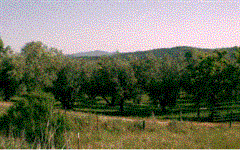
A few days rambling around a rural town in Northern California.
As the lowlands of California’s Sacramento Valley give way to the Westernmost reaches of the Sierra Nevada Mountain Range there is an in-between area: foothills bumping up from the Earth with hills and dales not often given more than a cursory glance in travel guidebooks.
Born as Ophir City, Oroville was a tent town in the mid 1800’s, when prospectors came to seek their fortunes near the Feather River. No outstanding gold strikes were mined from what Ophir City’s history pages have to tell, but, nevertheless, the name was changed to Oroville, Spanish for City of Gold in 1856.
Downtown Oroville is wonderful, although careworn in certain blocks. Victorian era houses sporting gingerbread trim and magnificent gardens grace Montgomery and Bird Streets, while dilapidated buildings stand unwanted and misused only blocks away. Being the county seat of Butte County, Oroville has the obligation of enduring those welfare recipients whose main purpose in life seems to walk (or, for the more affluent, ride a decrepit bike) aimlessly about town, poking into garbage bins looking for goodies. For a town with a population numbering just above 12,000 residents there are a good many drifters and others soaking up the county’s coffers.
Regardless of whether there are bums wandering the streets and boarded-up businesses or not, Oroville is a lovely town. Downtown has had a swift stroke at being revitalized, with period buildings being well kept, murals painted upon walls, regular festivals and a general community atmosphere that rings out pride in the area.
A stroll along the paved trail next to the Feather River and its levee is in order, as is a transpontine walk across the old Thermalito Bridge to the fish hatchery. In the vicinity is The Boss, home to possibly the finest hamburgers in the world, forcefully seasoned, tastefully condimented and grilled to perfection.
A local landmark, Table Mountain, is worthy of an exploration. The “Block O” is visible from miles south of the city limits. This concrete “O” was built in 1929 by enterprising youths of Oroville High School and has overlooked the city, with occasional touch-ups, since that time. My hope was, if time allowed, to hike to the top of this mesa but time grew short and I had to be content to drive my rental car up the twisting and turning Cherokee Road to the flat top of the mountain. Snapping a few pictures of the springtime wildflowers and the covered bridge, I watched the morning sun do its work as it sent shivers of sweet, evaporating dew into the air.
The tallest dam in the United States is located only a few miles up into the foothills outside of Oroville’s city limits. With the heavy winter rains and snow-pack from the Sierras melting, man-made Lake Oroville (a prime bass fishing locale) was near its peak on my visit, with boat ramps submerged by the spring waters. The dam’s visitors’ center, with its displays of Indian and frontier life as well as exhibits of the history and subterranean inner workings of the dam, holds a curiosity seeker’s interest for some while before it’s time to move on.
A great pleasure was driving the foothills of Northern California on a Sunday morning before leaving town. Up and down the hills and dales, winding and turning, sometimes full throttle — other times stopping to get out of the car and walk around. As I ambled, cattle lowed, roosters crowed and birds sang to fascinate the ears. The scent of wildflowers and fresh grass did wonders for titillating the nose, and I did get chased by a pair of dogs guarding their property, which only made the morning that much more thrilling, but reminded me that it was time to make tracks from these foothills and head away from this comely slice of rural Northern California.
© 2003 Todd Wisti
Todd Wisti is the author of the travelogue "Full English Breakfast."
|